District Maps
To view PDFs, Adobe Acrobat Reader 4.0 or higher is required-- get a free copy of Acrobat Reader X.
To request information from any cartographic document in an alternative format call (651) 366-4718 or (800) 657-3774 (Greater Minnesota); 711 or (800) 627-3529 (Minnesota Relay). You may also send an email to ADArequest.dot@state.mn.us. Please request at least one week in advance.
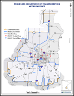 Construction & Maintenance District Maps
Showing MnDOT construction and maintenance district boundaries and district offices
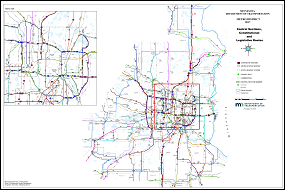 Control Sections, Constitutional & Legislative Routes
Showing MnDOT state highway control sections, constitutional & legislative highway routes