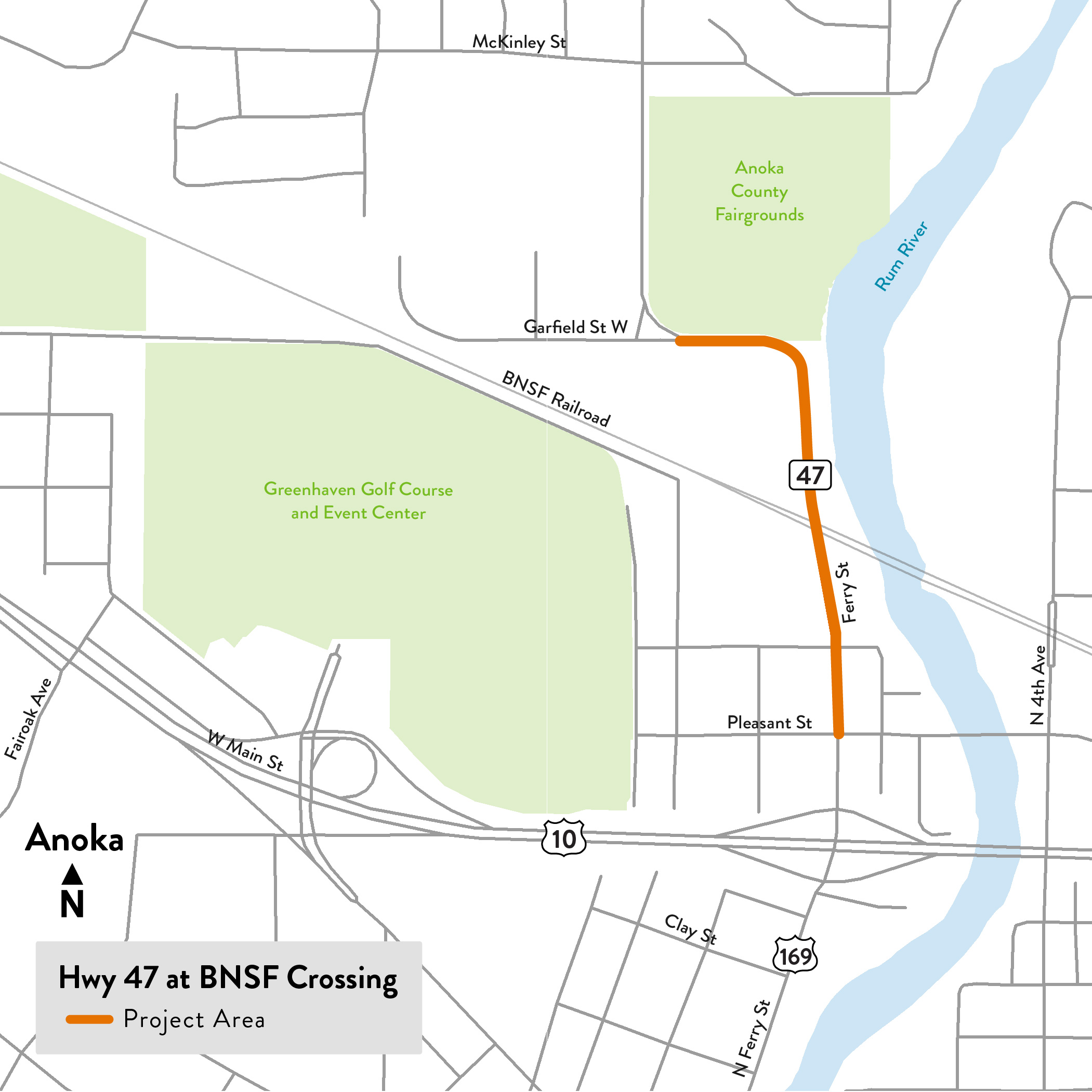
In 2020, the State Legislature awarded bonding funds to make safety improvements at priority railway crossings, including this one. We we’re working to improve the Hwy 47 (Ferry St.) at BNSF crossing in Anoka. In 2016, MnDOT completed a study of safety issues at this crossing. The study recommended separating the highway and railroad crossing by constructing a bridge over the train tracks. In 2020 the State Legislature awarded bonding funds to make safety improvements. Our goal was to identify a safer crossing of Hwy 47 and BNSF Railroad crossing; the entire area from Pleasant St. to Garfield St. W. was part of the study area as we evaluated:
Redesigning the crossing by constructing a bridge either over or under the train tracks.
Explored some of the surrounding intersections and conditions that need improvements.
There were three parts to this study:
Evaluate the BNSF railroad crossing
Evaluate Martin St. and Pleasant St. intersections
Evaluate Hwy 47 alignment
The public had several opportunities to provide input, review alternatives, and stay informed throughout the study.
Summary of work
Environmental process and the preliminary design
Identified and confirmed project issues and concerns
Provided alternatives to address concerns
Reviewed information from the 2016 study and talk with community, businesses, emergency services, school district
Determined if the original recommendation of routing the highway over the railroad was the best option
Presented an approved project layout and environmental report
Finalized design plans
What we heard from the community
Public engagement has helped identify the community’s concerns and desired improvements for the project area. Over the past two years, the project planning team has had conversations with Anoka residents, businesses, and stakeholders via one-on-one phone calls, emails, small group listening sessions, meetings with nearby businesses, surveys, neighborhood meetings and open houses.
Public meetings:
In November 2022 approximately 80 people attended a public meeting at Anoka-Hennepin Education Service Center.
In May 2022 over 300 people attended a public meeting at Anoka-Hennepin Education Service Center.
In February 2022 a neighborhood meeting was hosted for residents near Martin St. and Pleasant St. intersections.
In September 2021, community members were invited to complete a questionnaire to describe their problems, concerns, experiences and priorities for the Hwy 47 and BNSF railroad crossing. 1,039 residents, businesses, commuters and stakeholders completed the survey; their responses helped identify the project area’s main transportation problems and the ways that people wanted those problems to be addressed.
Businesses and agency outreach:
A1 Recycling
Aero Materials
Alter Metals
Anoka County Fairgrounds
Anoka County Parks Dept
Anoka County staff
County Board Meetings
Anoka Hennepin School District
Anoka Today Alano
City of Anoka staff
City Council meetings
Emergency Services (fire, ambulance, police)
JEM Auto Sales
MN Firearms Training
Top concerns with delays due to:
Trains and gate timing at the railroad crossing
Rush hour backups
Blocking due to vehicles turning into side roads and driveways
Top concerns with safety due to:
Emergency Services response times
Sight lines at and near the railroad crossing
Tight curves
Drivers taking alternate routes through neighborhoods
Not enough separation of cars to bikes and pedestrians
Concerns with surrounding impacts:
Significant impacts on local businesses, employees and customers
Environmental impacts, specifically impacts on the river, floodway, park land and trails
Desired improvements in the project area:
Provide either an overpass or underpass at the railroad crossing ; support for a two-lane bridge with potential for future widening to four lanes
Improve conditions for emergency services
Make road wider with either more lanes or turn lanes
Ease the tight curves
Ensure an appropriate speed for the curves and business/residential access
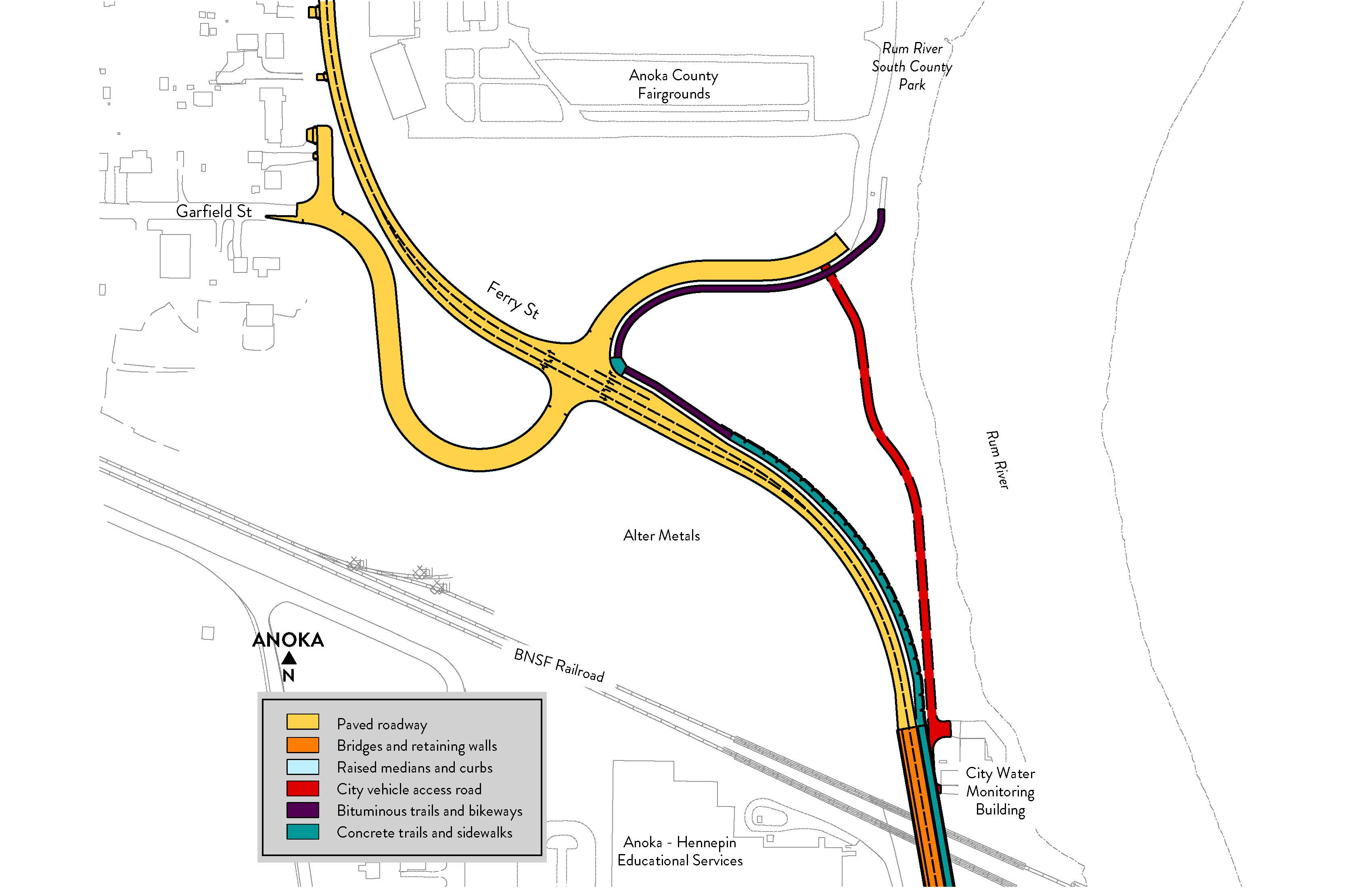
BNSF Railroad crossing
Challenges
Lots of vehicle and train traffic.
Trains traveling as fast as 75 mph.
Major property damage.
Serious injuries and fatalities.
Priorities
Safety for drivers, pedestrians, bicyclists and trains.
Traffic flow: Faster drive times and quicker for emergency services.
Trail space: Multi-use for pedestrians and bicyclists.
Intersections south of crossing
Challenges
Drivers experiencing backups and delays.
Anticipated future increase in vehicles.
Safety of pedestrians and drivers at each intersection.
Proximity of roadway overpass to the intersection.
Priorities
Maintain pedestrian access and crossings.
Support future capacity for the road.
Improve safety for drivers and pedestrians.
Maintain access for residents.
Minimize traffic impacts on surrounding neighborhoods.
Hwy 47 alignment north of crossing
Challenges
Sharp curves create safety issues.
Speed limit range is inconsistent in the area.
Multiple businesses, properties and parks may be impacted.
Priorities
Change roadway curve to improve safety.
Minimize impacts on Rum River.
Consider the impacts to businesses, properties and parks.
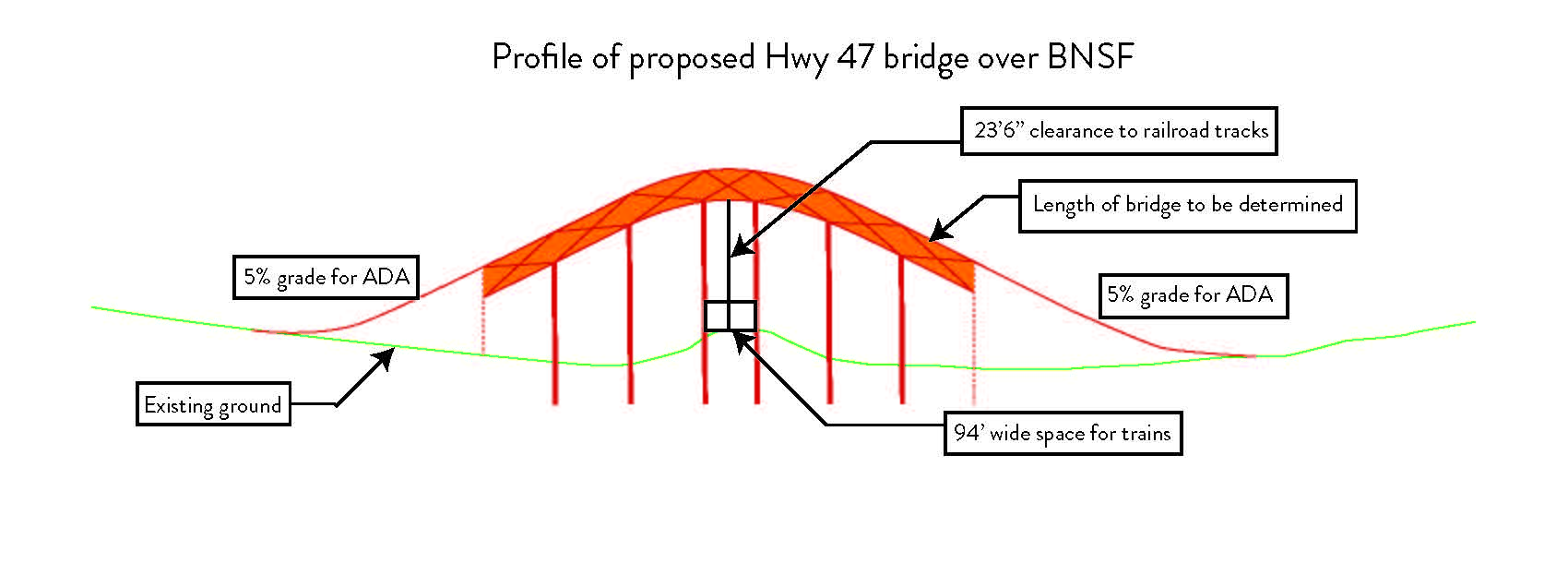
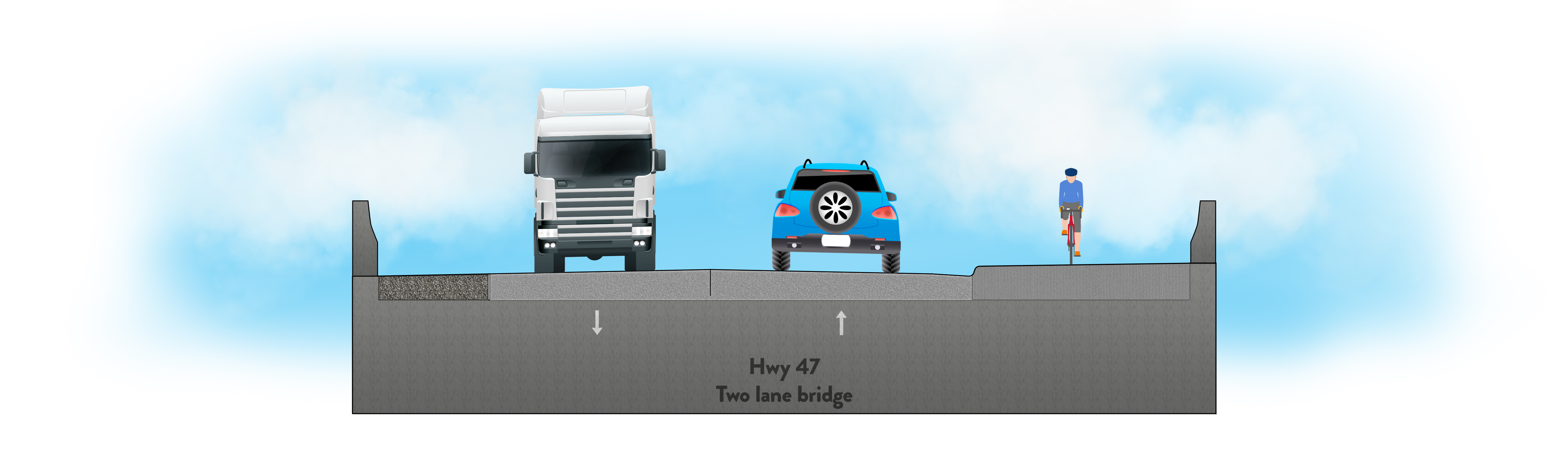
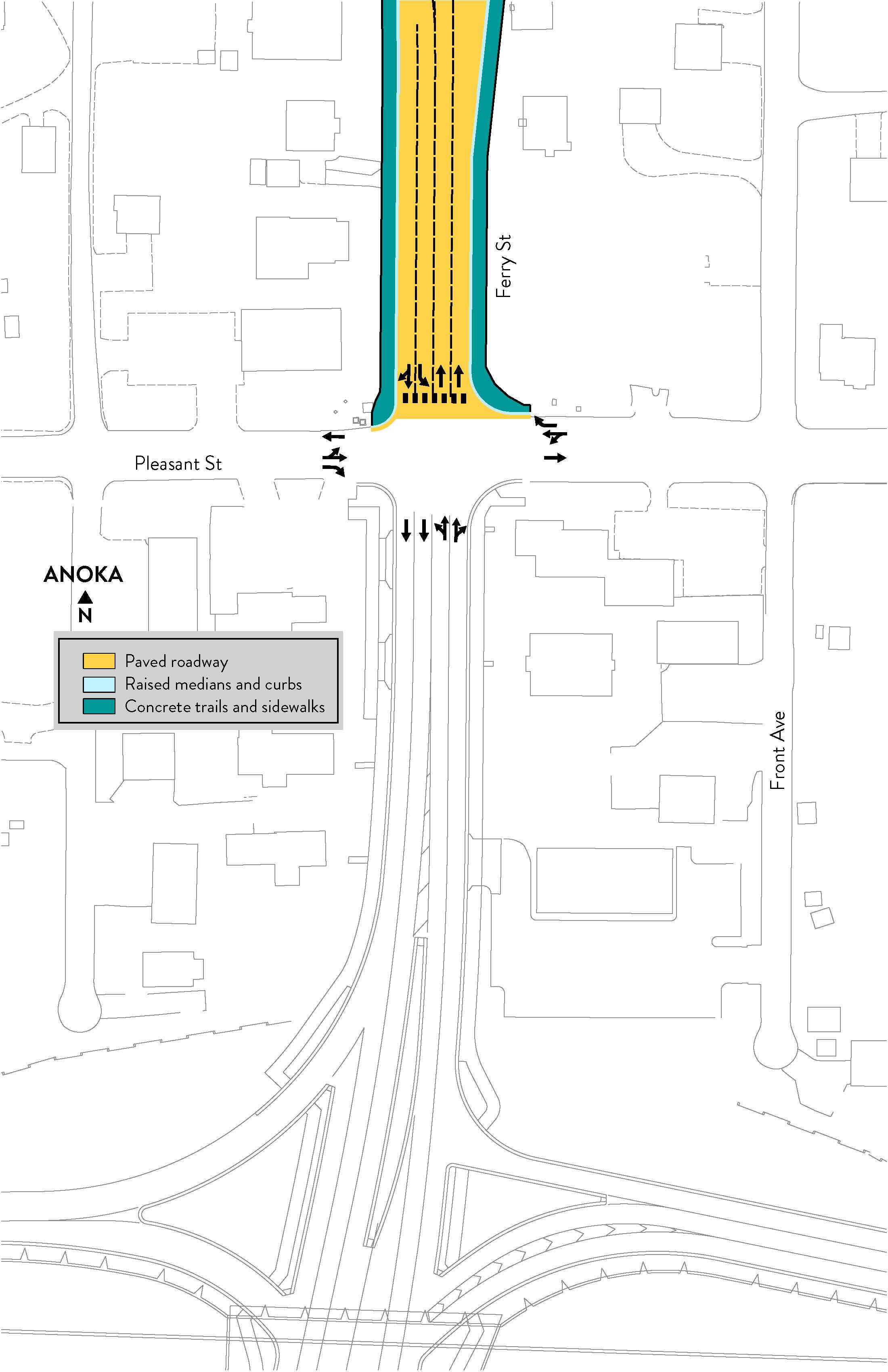
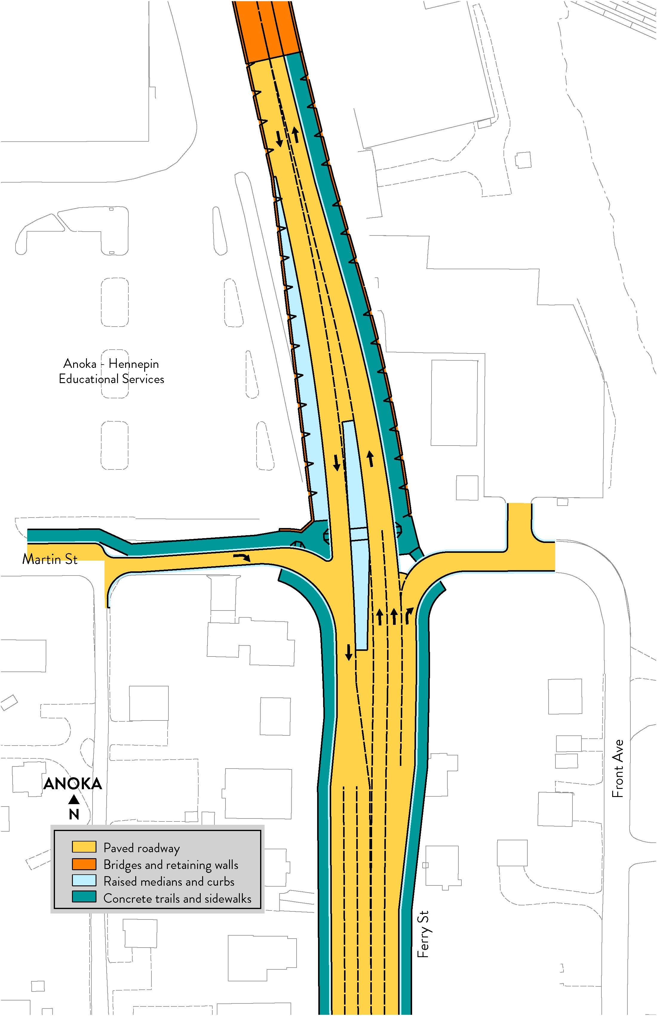
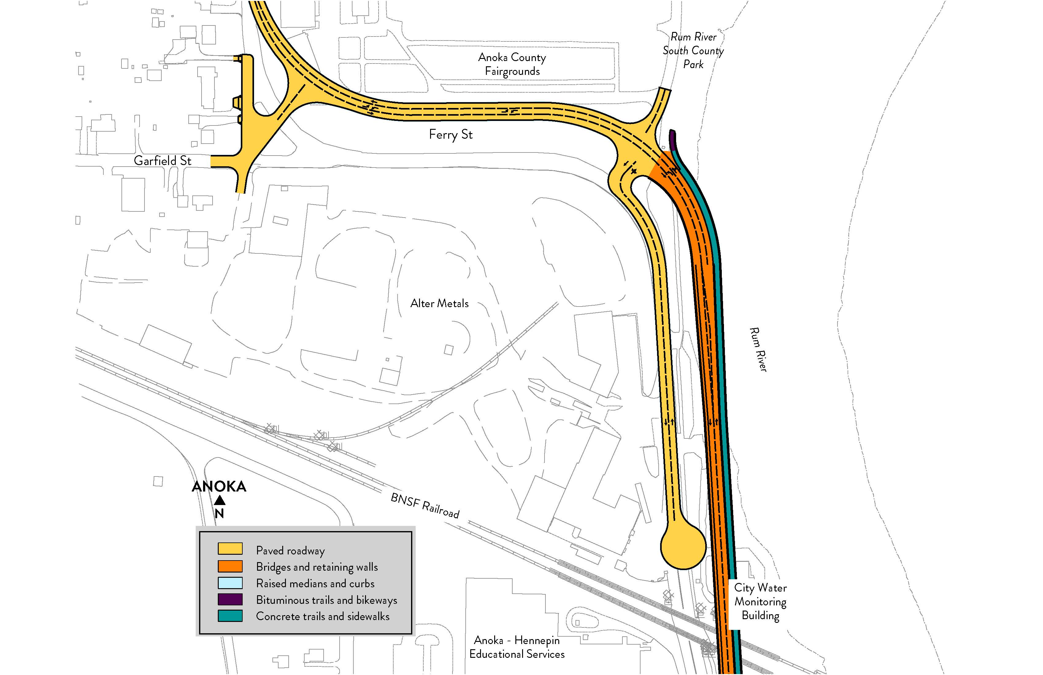
Hwy 47 and BNSF crossing: Recommended alternative – overpass
Key elements:
Separates drivers from the trains on a bridge over the tracks
Separates pedestrians and bicyclists from the trains on a bridge over the tracks
Meets ADA compliance
Scale not reflective of actual proposed bridge.
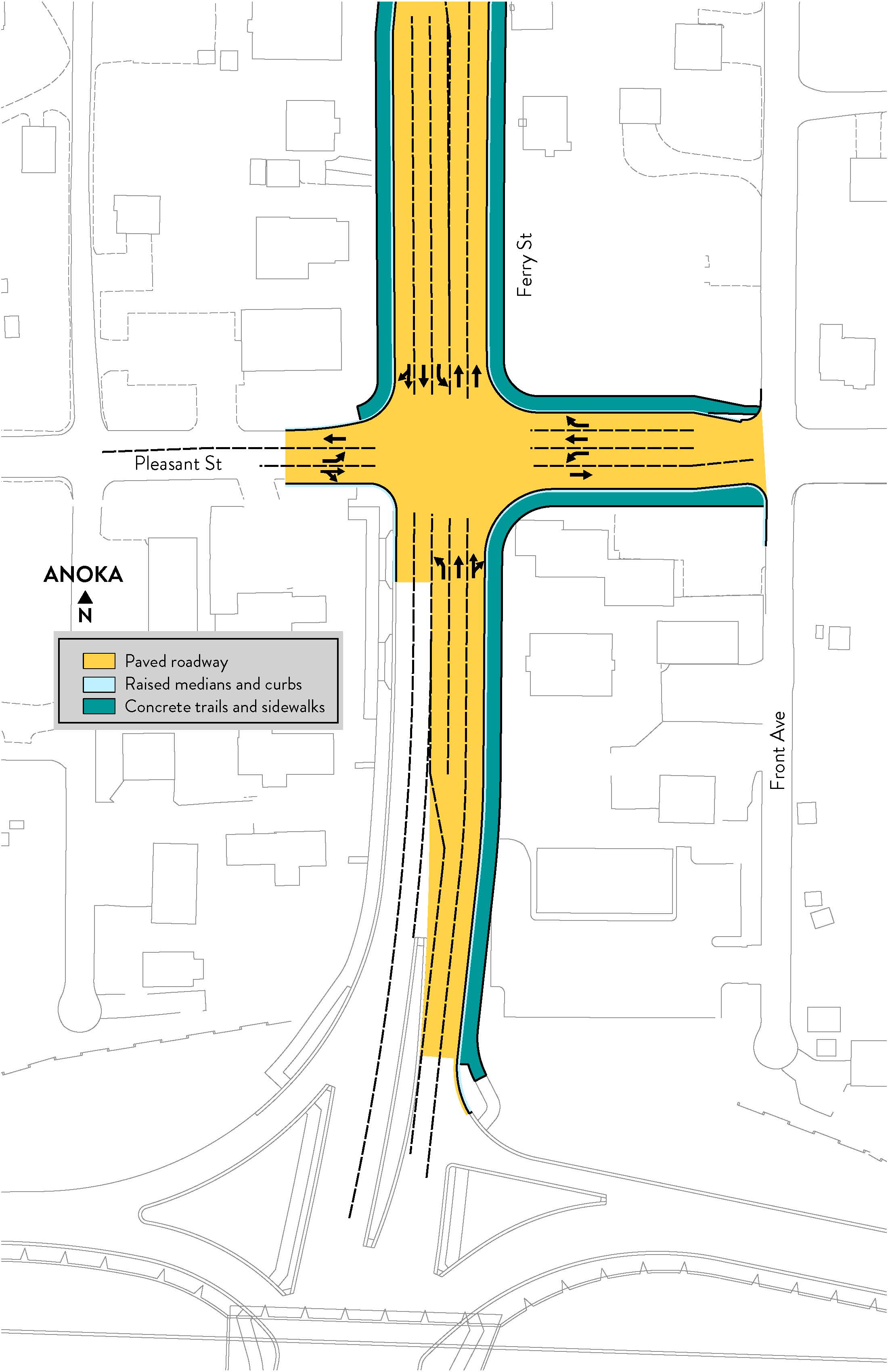
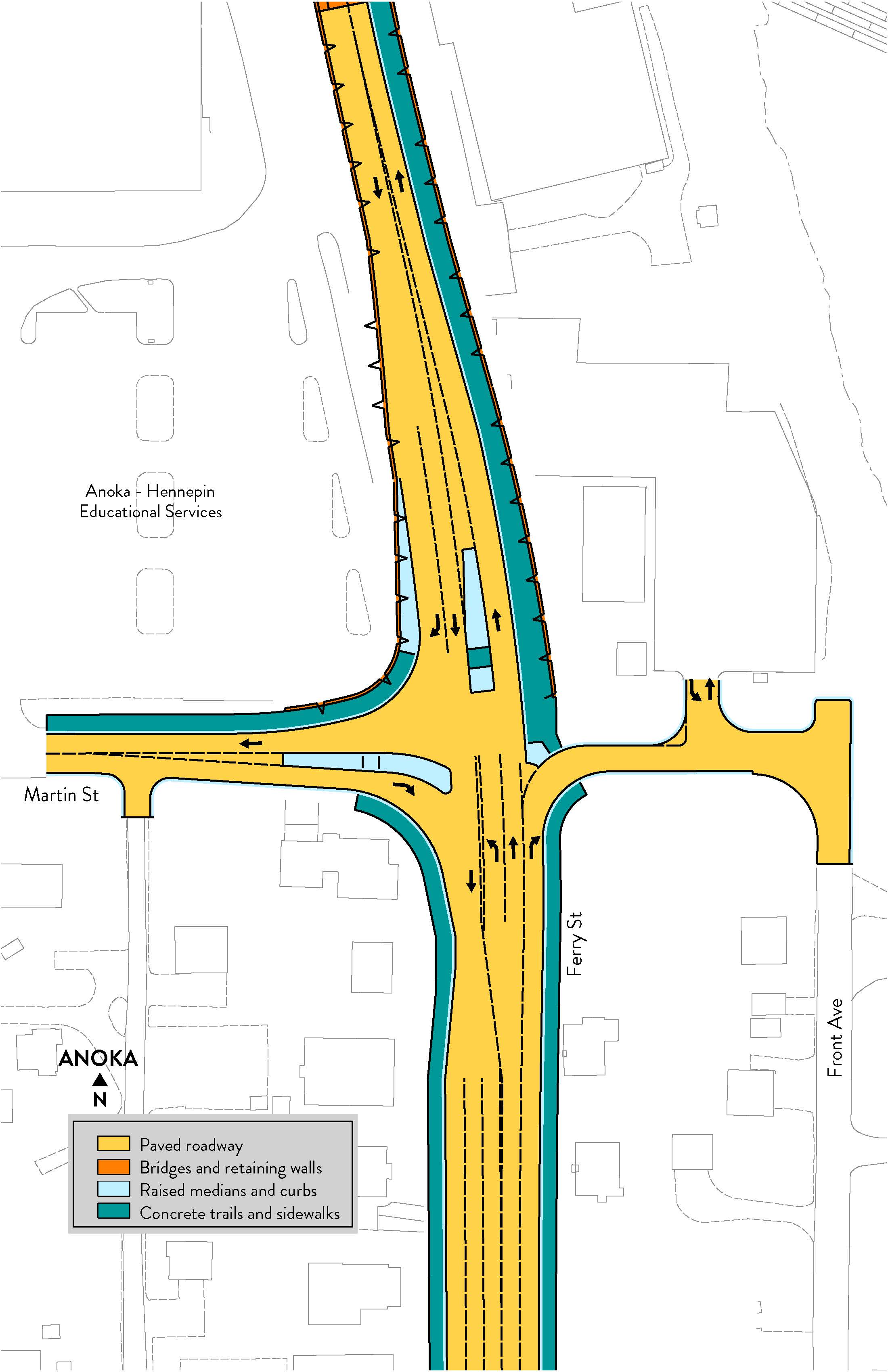
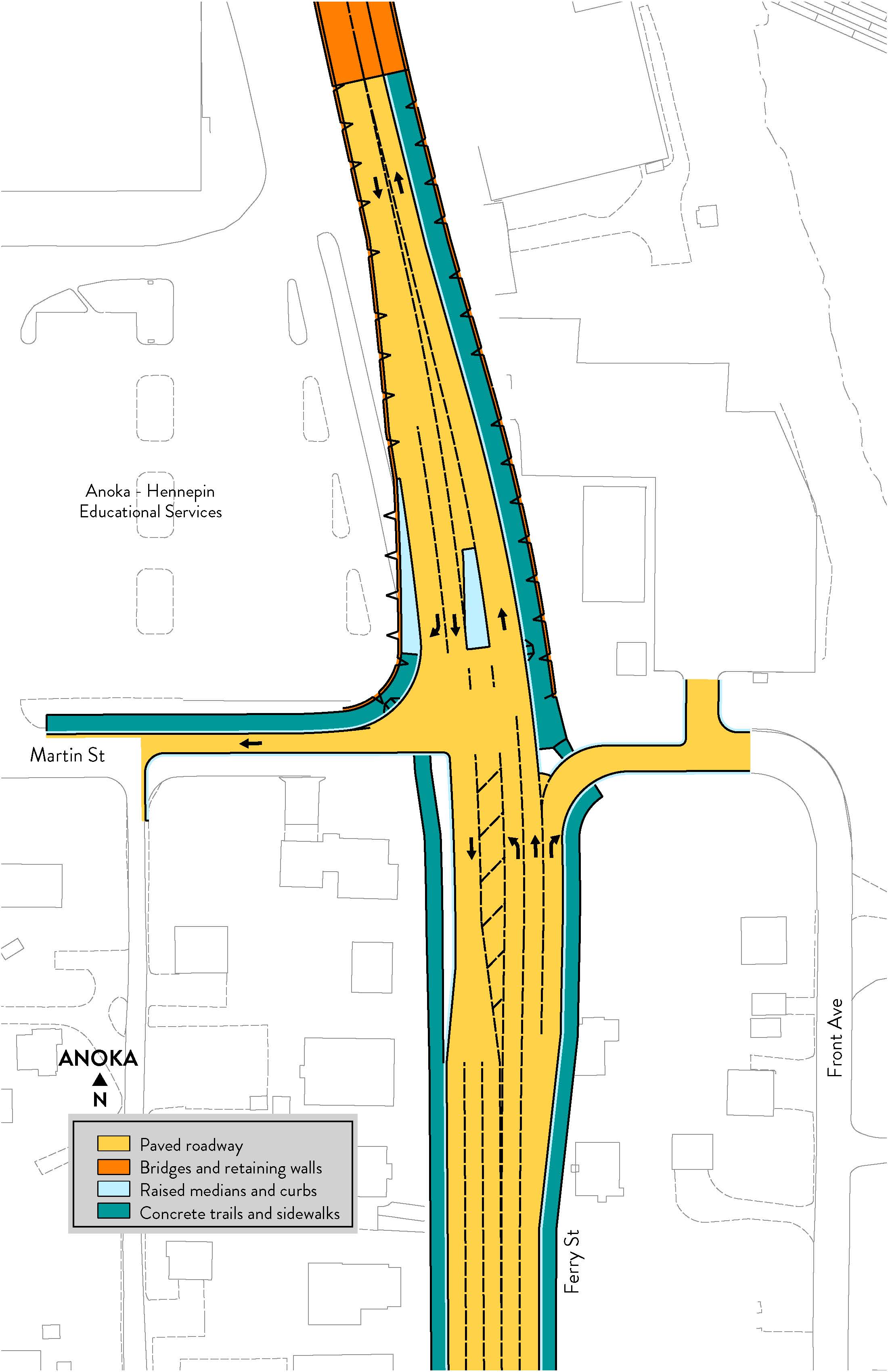
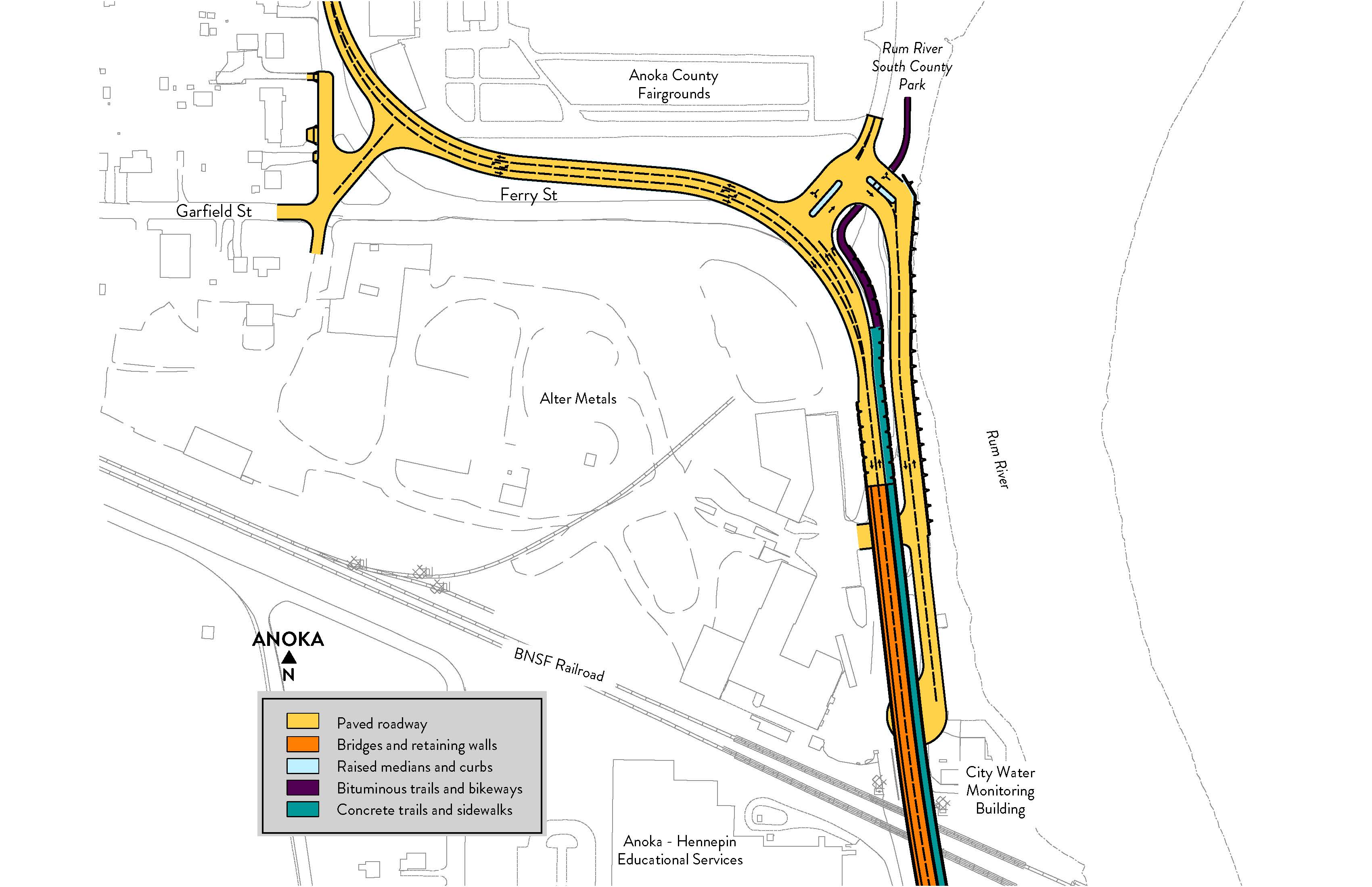
Ferry St. at Pleasant St.: Recommended alternative - added independent left turn lanes
Key elements:
Left turn lanes are added for northbound, eastbound, and westbound.
Southbound left turn lane is extended.
Pedestrian access and crossings stay the same.
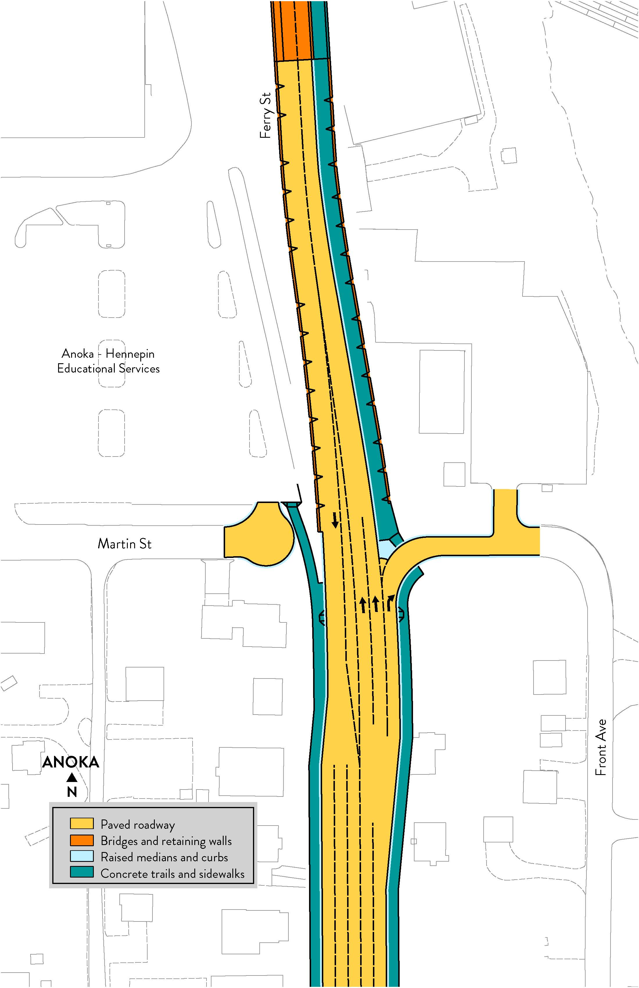
Ferry St. at Martin St.: Recommended alternative – access alternative
Key elements:
Access to Martin St. from Hwy 47 is maintained.
Only access to Hwy 47 is from eastbound Martin St. to southbound Hwy 47.
Improved pedestrian access with a Hwy 47 crossing with a pedestrian refuge median north of Martin St.
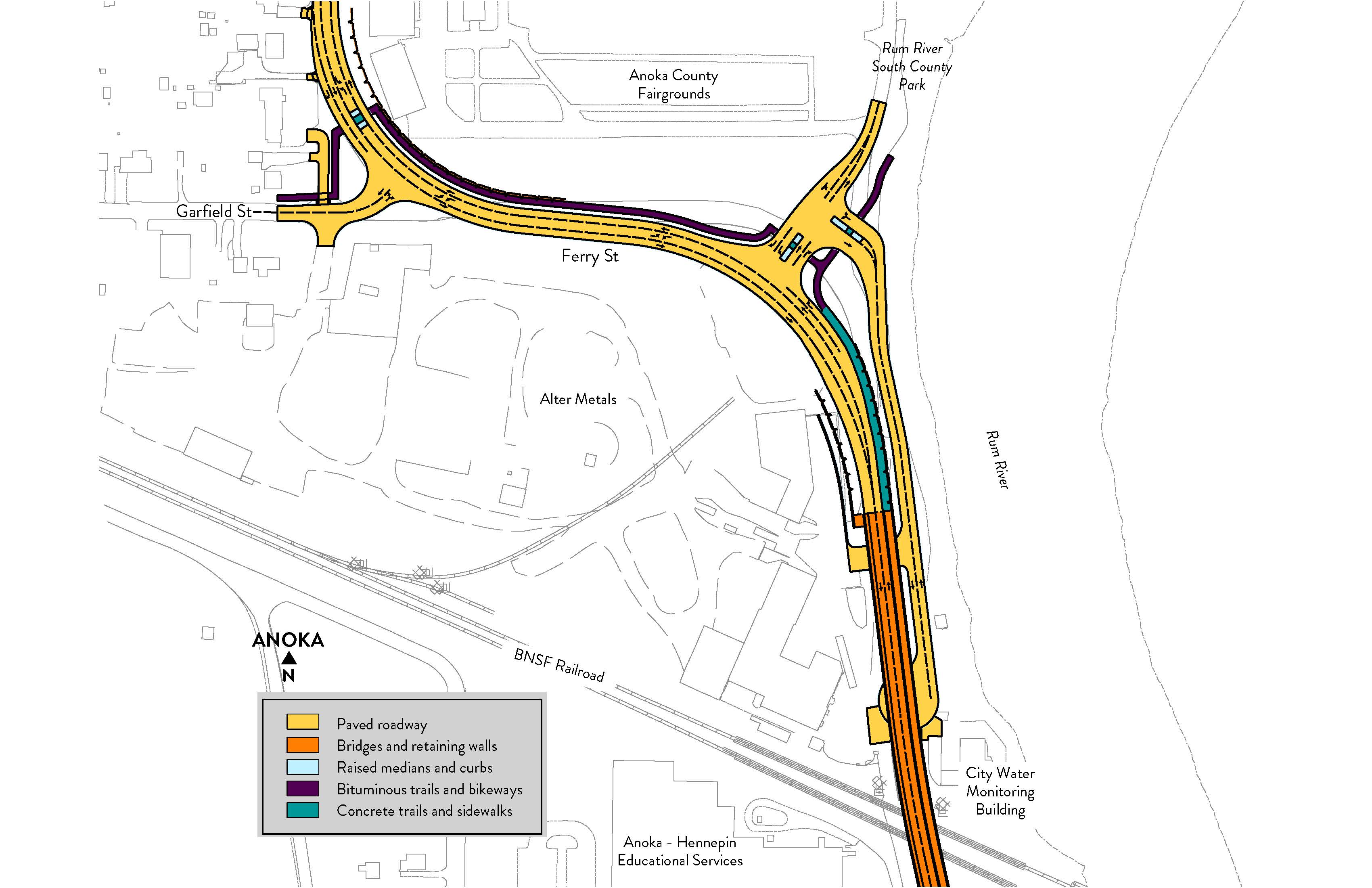
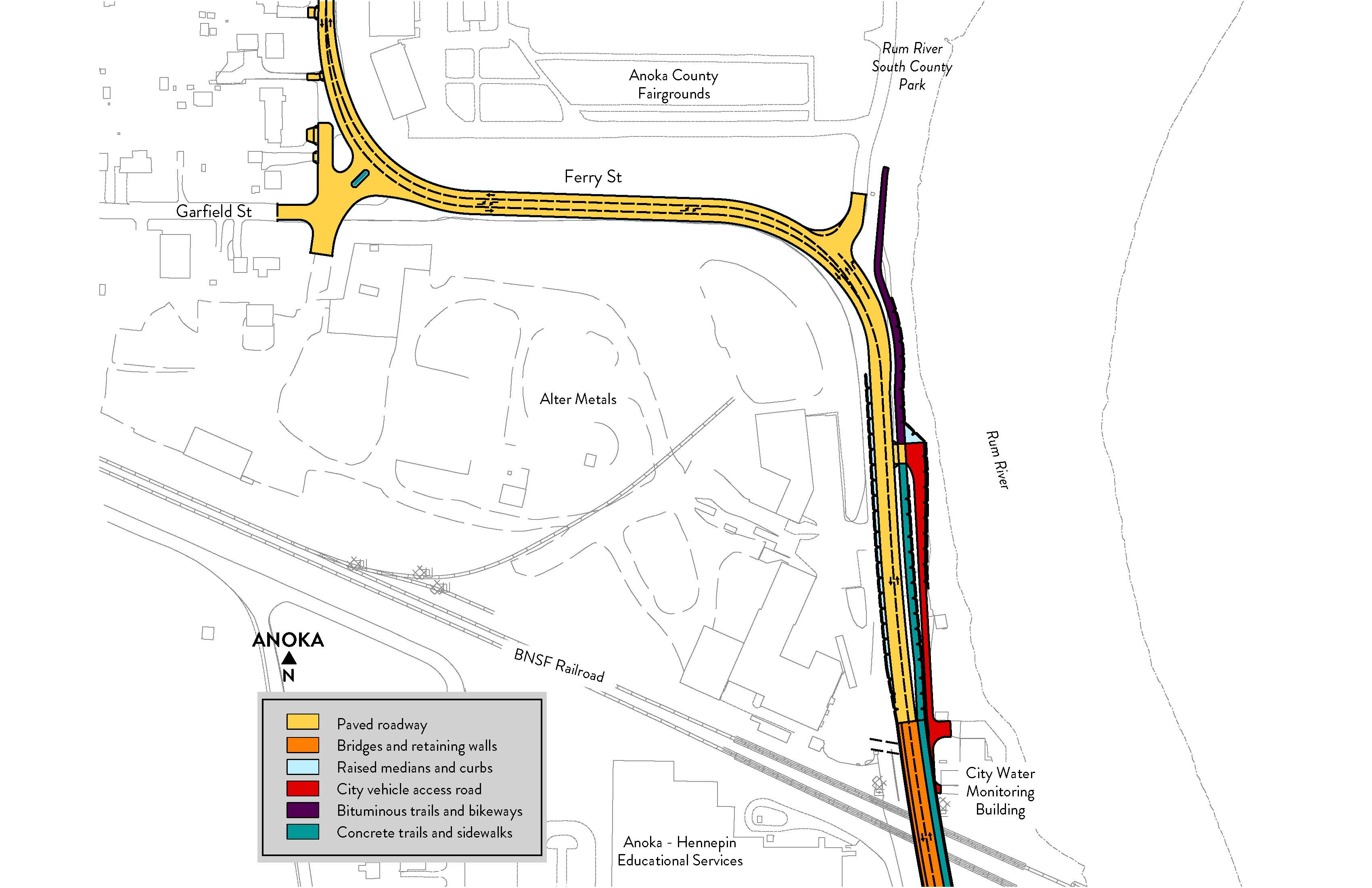
Hwy 47 alignment: Recommended alternative – alignment alternative 5
Key elements:
Some impacts to Alter Metals property.
No impacts to Rum River floodway.
Minimal impacts to Rum River state-designated Wild and Scenic River.
Some impacts to Anoka County Fairgrounds property.
Replacement of Rum River South County Park land required.
Smoother curve allows for a safe and consistent 35 mph speed limit throughout project area.
Total project cost: $25 million to $45 million
Grade separation of railroad
Increase safety for drivers, pedestrians, bicyclists and trains.
Reduced delays and travel times.
More reliable for emergency services.
Intersection improvements
North and south turn lanes at Pleasant St. aligned, creating better visibility and easier navigation.
Straighter curves
Provides consistent speed limit north of the railroad crossing.
Better visibility.
Neighborhood traffic minimized
Turn lanes at Martin St. reduce some traffic from cutting through the neighborhood.
Better access
Improved visibility enables easier turns to get on and off Hwy 47.
Left turn lanes added throughout project area.
Bike and pedestrian
Improvements at Martin St. and Pleasant St.
Safer crossing over the railroad.
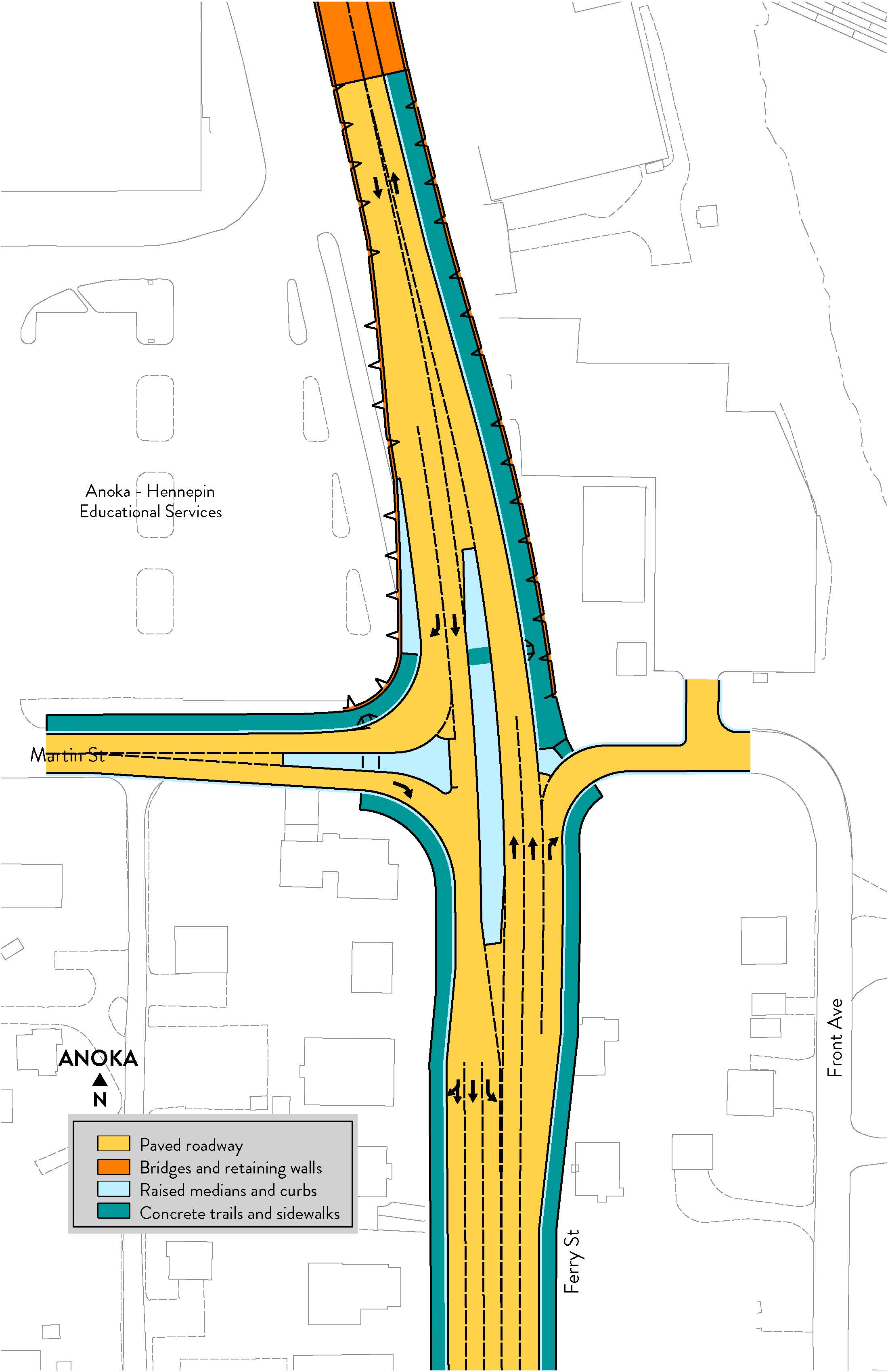
Ferry St. at Pleasant St.: Dismissed alternative
Disadvantages:
May not meet capacity needs in the future.
Location of left turn lanes limits visibility.
Ferry St. at Martin St.: Dismissed alternatives
Alternative 1: Minimal access
Alternative 1 disadvantages:
Results in largest rerouting of traffic through the neighborhood to and from Pleasant St. to access Hwy 47.
Alternative 2: In only alternative
Alternative 2 disadvantages:
EB Martin St. traffic would be rerouted through the neighborhood to Pleasant St. to access Hwy 47, resulting in increased traffic through neighborhoods.
Alternative 4: Out only alternative
Alternative 4 disadvantages:
NB left turn and southbound right turn vehicles would be rerouted to Pleasant St., resulting in increased traffic through neighborhoods.
Alternative 5: Right in right out
Alternative 5 disadvantages:
NB left turn vehicles would be rerouted to Pleasant St. and through neighborhood. Resulting in increase in traffic through neighborhoods.
Hwy 47 alignment: Dismissed alternatives
Alternative 1
Alternative 1 disadvantages:
Requires relocation of main entrance of Alter Metals to Garfield St.
Does not change road curves or speed limit.
Impacts to Rum River state-designated Wild and Scenic River.
Total project cost: $25 million to $40 million
Alternative 2
Alternative 2 disadvantages:
Major impacts to Alter Metals property.
Total project cost: $50 million to $140 million
Alternative 3
Alternative 3 disadvantages:
Impacts to Rum River floodway and state-designated Wild and Scenic River.
Impacts to Anoka County Fairgrounds property.
Impacts to City well house.
Replacement of Rum River South County Park land required.
Total project cost: $30 million to $50 million
Alternative 4
Alternative 4 disadvantages:
Impacts to Rum River floodway and state-designated Wild and Scenic River.
Impacts to Anoka County Fairgrounds property.
Replacement of Rum River South County Park land required.