About this project
Update
The majority of the project is complete, including the paving and concrete work and the traffic signal replacement at the intersection of Hwy 19 and Hwy 20. Crews are finishing minor landscaping work.
Summary of work
The purpose of this project is to address deteriorating pavement conditions on Hwy 19 in Cannon Falls, improve pedestrian and vehicle safety and meet the current Americans with Disabilities (ADA) standards.
Construction began April 1 and is scheduled to end in August. Work includes the following:
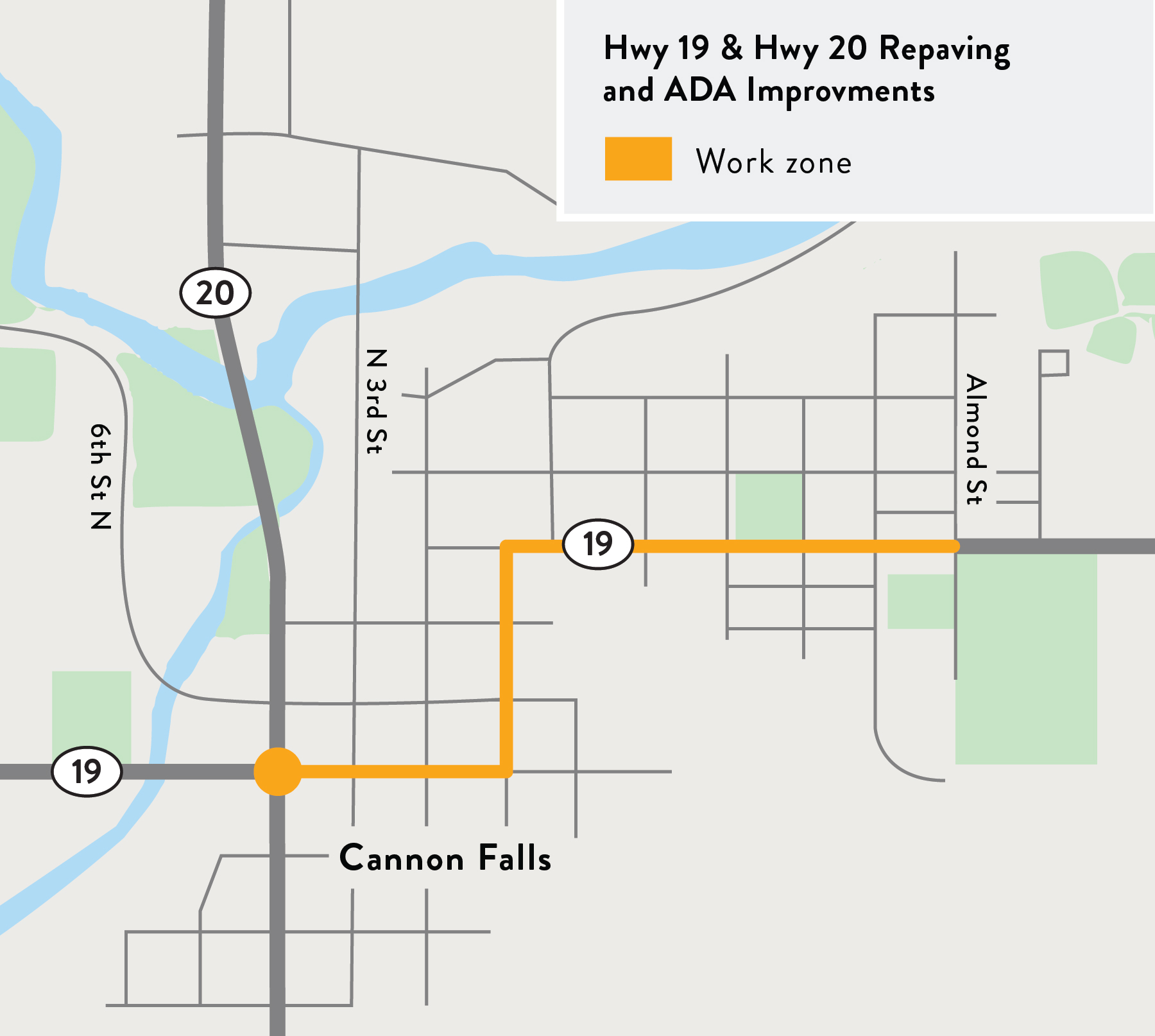
- Repaving Hwy 19 from 5th St. S to Almond St.
- Altering pedestrian bumpouts at the intersection of Hwy 19 and Hwy 20.
- Improving truck turning at the intersection of Hwy 19 and Hwy 20.
- Replacing traffic signal at the intersection of Hwy 19 and Hwy 20.
- Constructing new sidewalks to meet Americans with Disabilities (ADA) standards.
Details can be viewed on the project layout map.
Many of the planned changes to the sidewalks within the project area are because of the need to meet ADA regulations. In some places, the steep terrain creates many challenges in complying with those regulations and has resulted in some significant changes, including the construction of new sidewalks along 1st St. and State St. Please visit the Design Concepts tab for additional details and information about ADA standards and how they influenced the selection of certain design features.