Minnesota Department of Transportation

511 Travel Info

Highway 55/Olson Memorial Highway study

Minneapolis

Design alternatives

In 2023, we asked the community to share their ideas about Olson Memorial Hwy in North Minneapolis, how using the road feels today, and what is important to them.

We used that community input, along with technical analysis, to develop the four alternatives below. These alternatives are design concepts that show what the future of Olson Memorial Hwy could look like.

We would like to hear your feedback on these alternatives! Share your thoughts by taking our online survey through Wed, May 1!

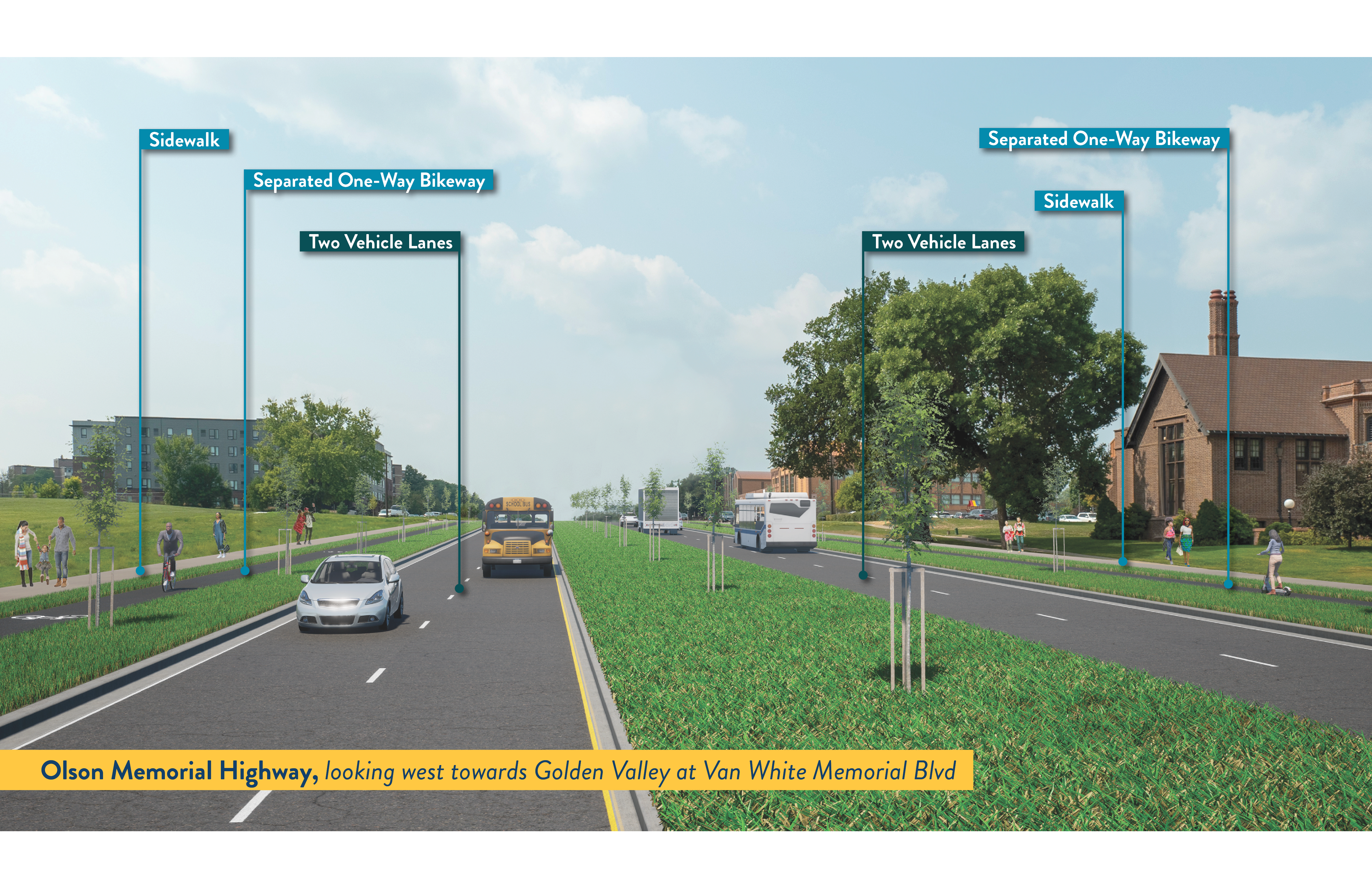
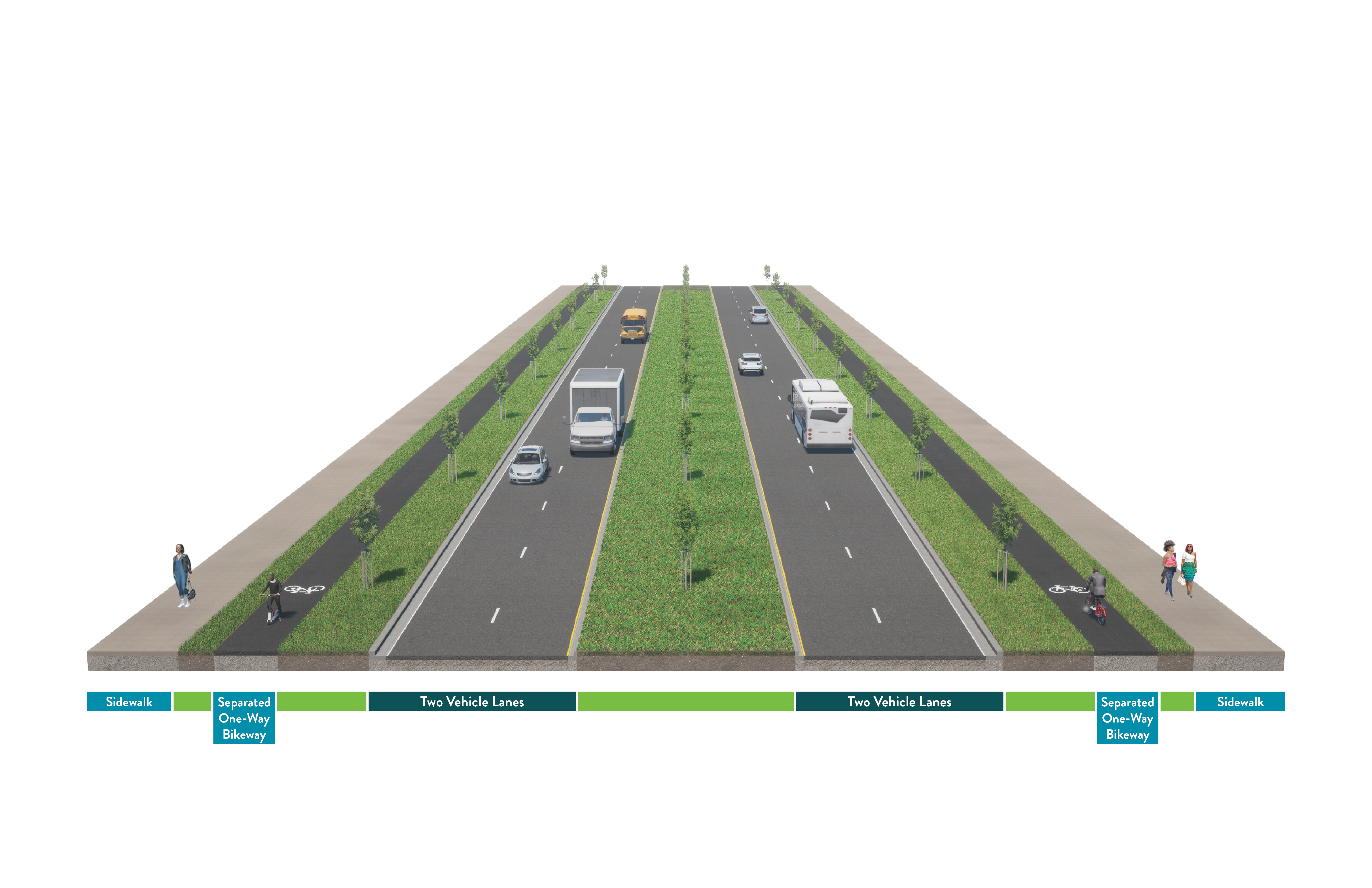
This alternative has two lanes of traffic in each direction, with sidewalks and separated one-way bikeways on each side of the road. People walking, rolling, and biking have four lanes of traffic to cross. Buses, cars, and trucks use the same lanes.

Graphic showing a four lane highway with people walking on the sidewalk, a biker, vehicles driving on the road.

View full size image

A cross section of a highway showing two vehicle lanes with vehicles, bike paths on each side of the road with bikers, and sidewalks on each side of the road with people walking on it.

View full size image

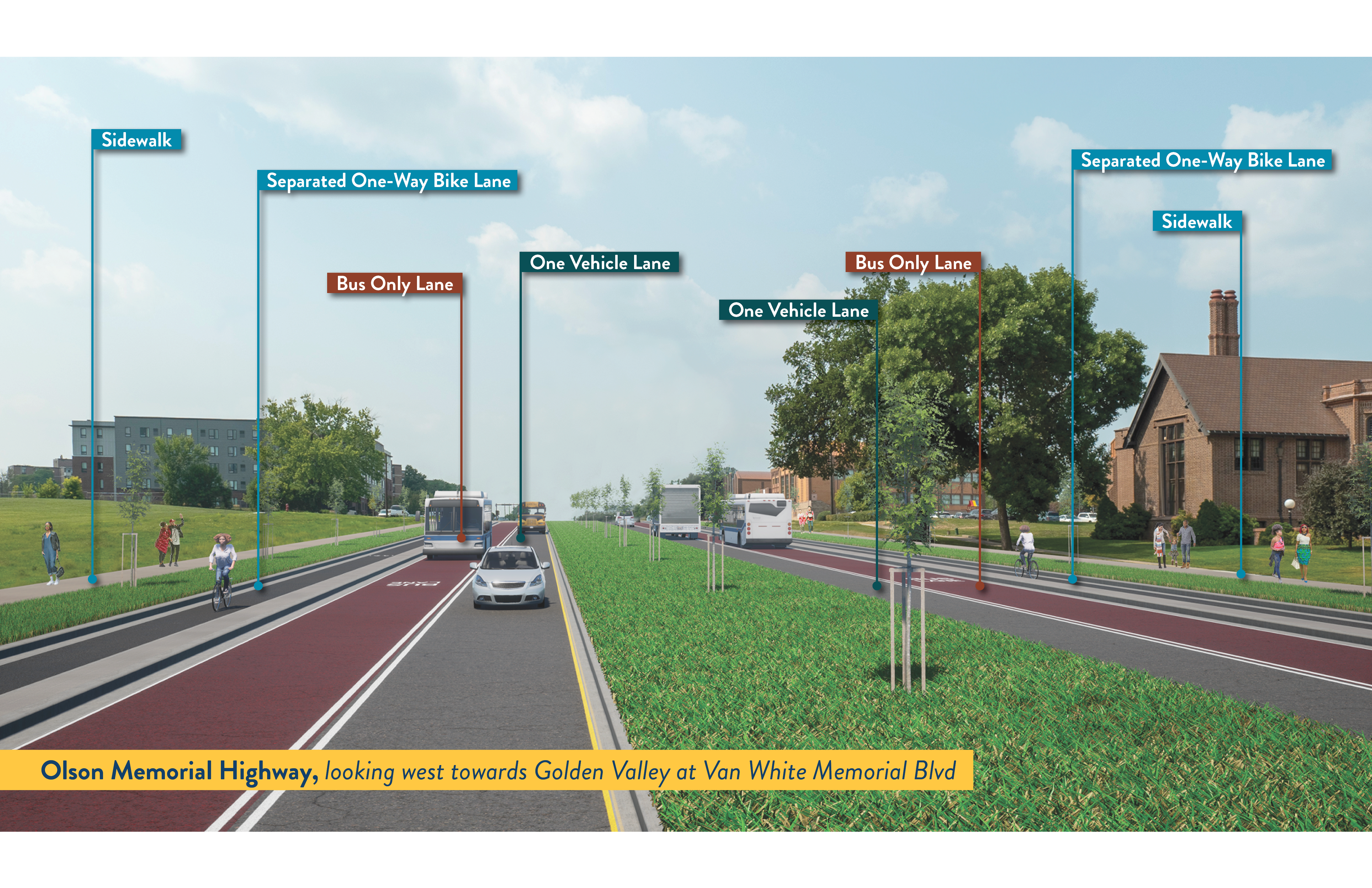
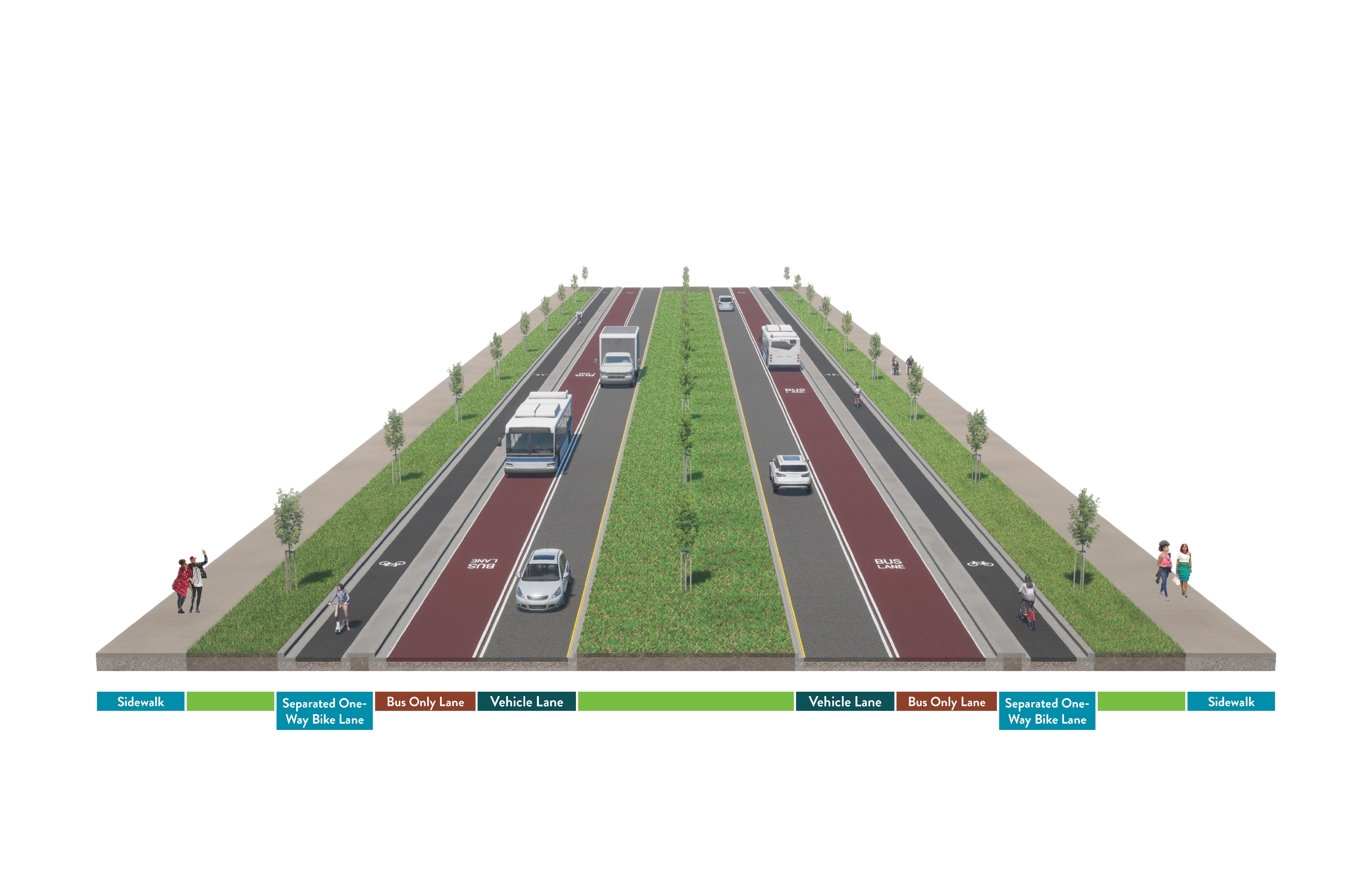
This alternative has a curbside bus only lane, one vehicle lane, sidewalks, and a separated one-way bike lane on each side of the road. People walking, rolling, and biking have four lanes of traffic to cross.

Graphic showing a highway with a bus only lane, one vehicle lane, and a bike lane on each side of the road. Vehicles are driving on the road, bikers are riding in the bike lane, and there are people walking on the sidewalk.

View full size image

A cross section of a highway showing sidewalks with people on them, bike lanes with bikers, bus lanes with buses, and a single vehicle lane showing cars and a truck in them.

View full size image

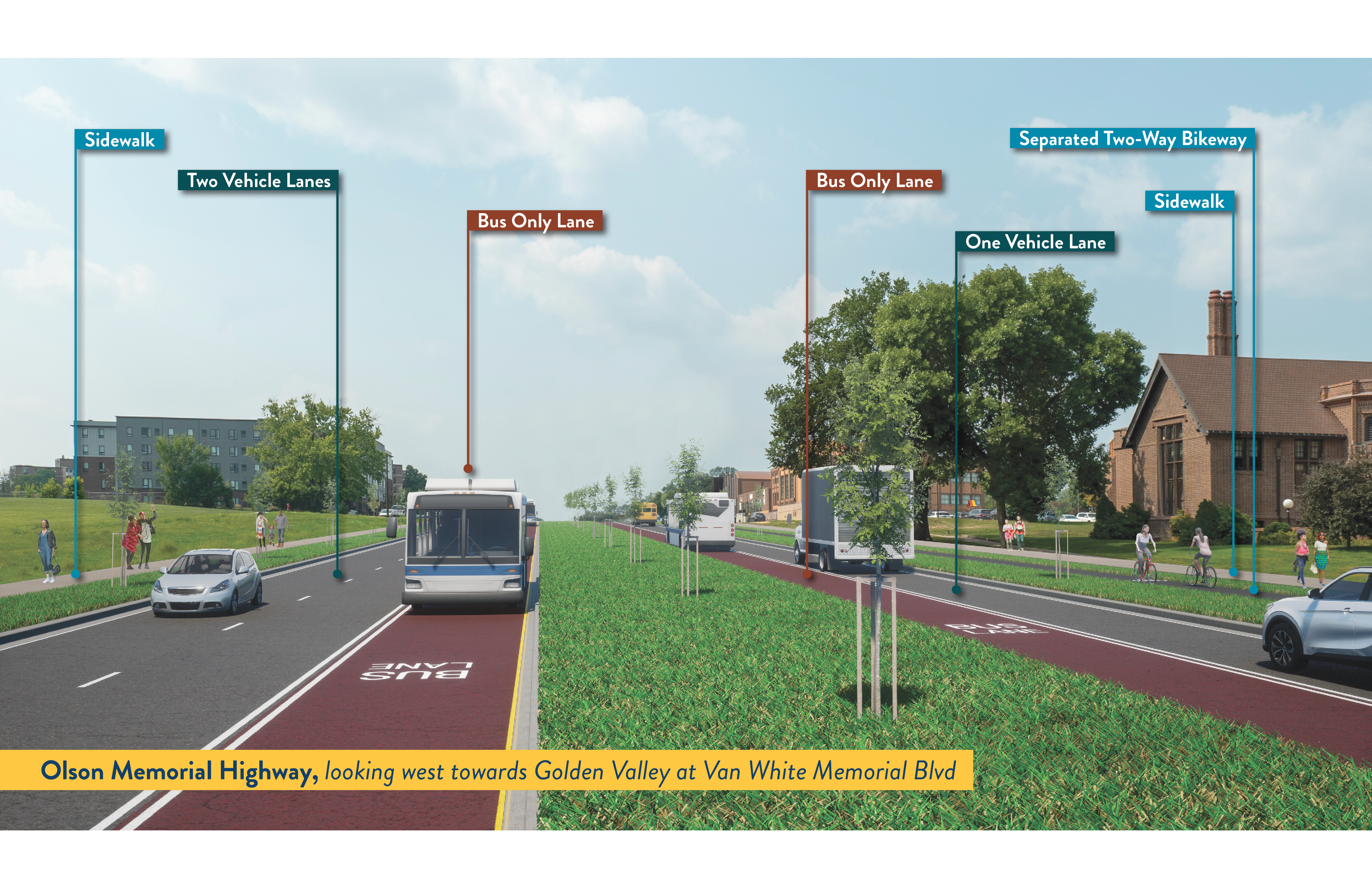
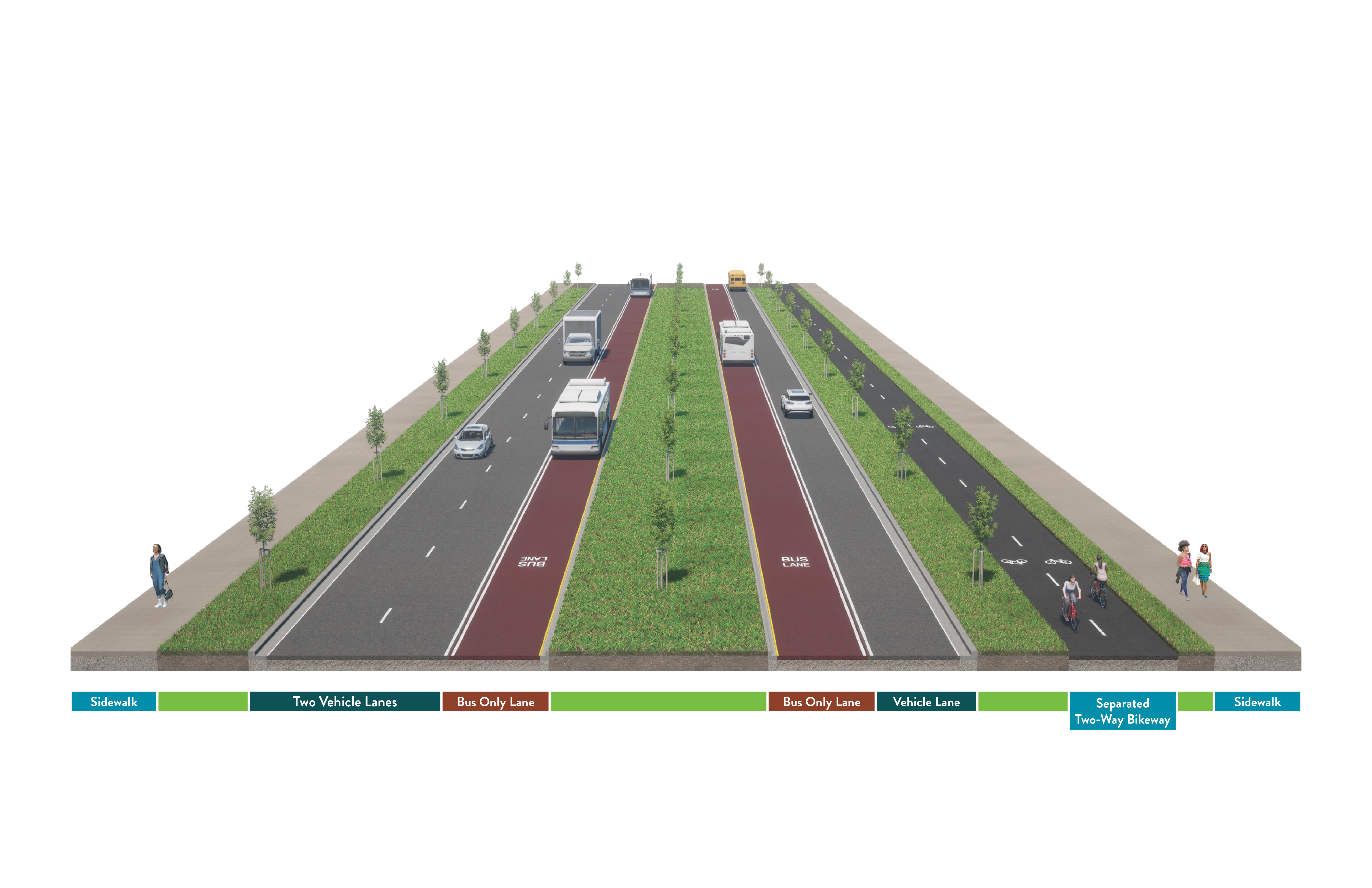
This alternative has center bus only lanes in each direction. There are two vehicle lanes heading towards downtown and one vehicle lane heading away from downtown. There is a separated two-way bikeway on one side of the road. People walking, rolling, and biking have five lanes of traffic to cross.

A highway showing two vehicle lanes, a bus only lane with a bus, and sidewalk with people walking on the eastbound side of the road. There is also a bus only lane with a bus, a single vehicle lane with a car and truck, a bike lane with bikers, and a sidewalk with people walking  on the westbound side of the road.

View full size image

A cross section of a highway showing two vehicle lanes, a bus only lane with a bus, and sidewalk with people walking on the eastbound side of the road. There is also a bus only lane with a bus, a single vehicle lane with a car and truck, a bike lane with bikers, and a sidewalk with people walking  on the westbound side of the road.

View full size image

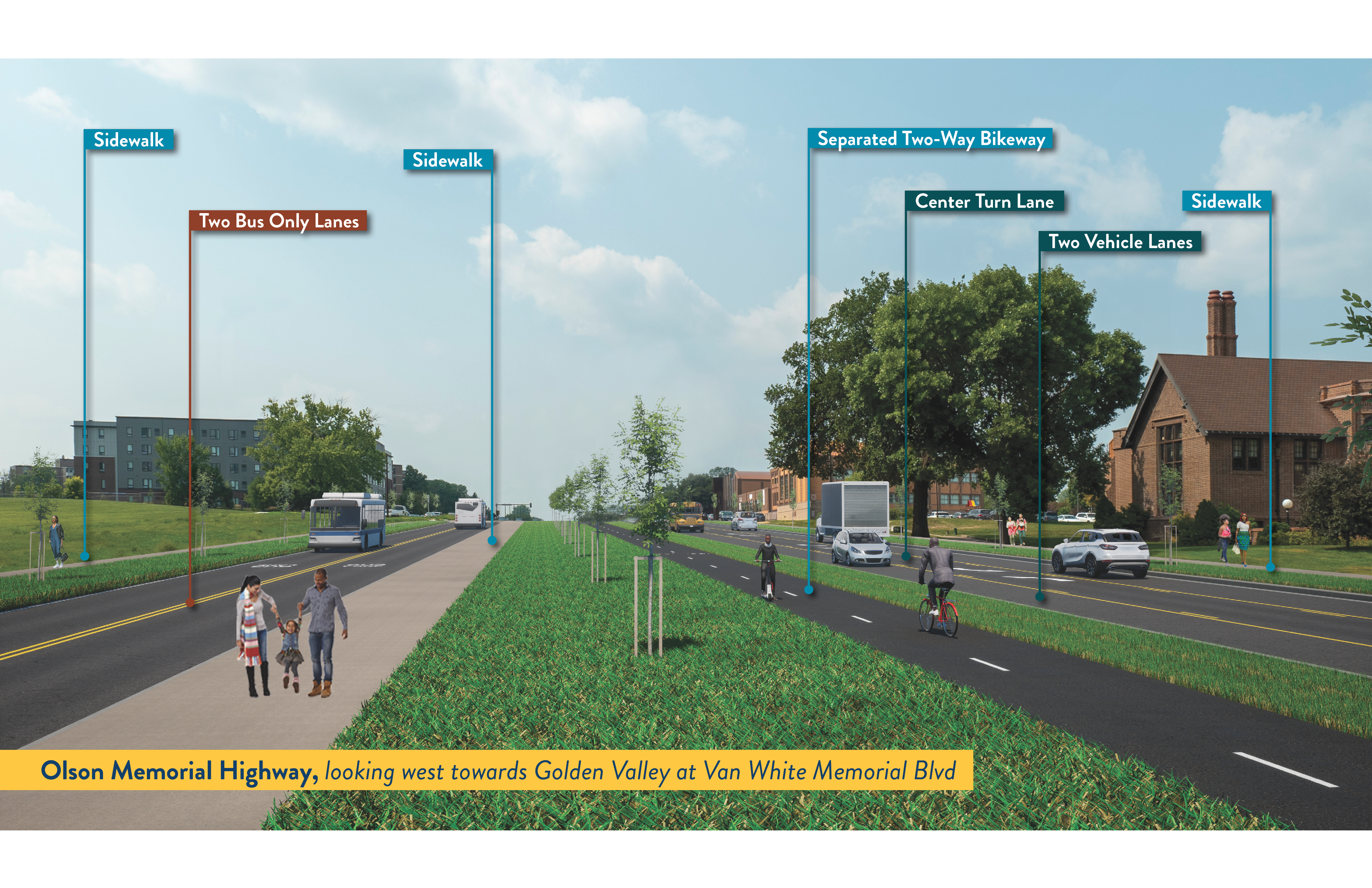
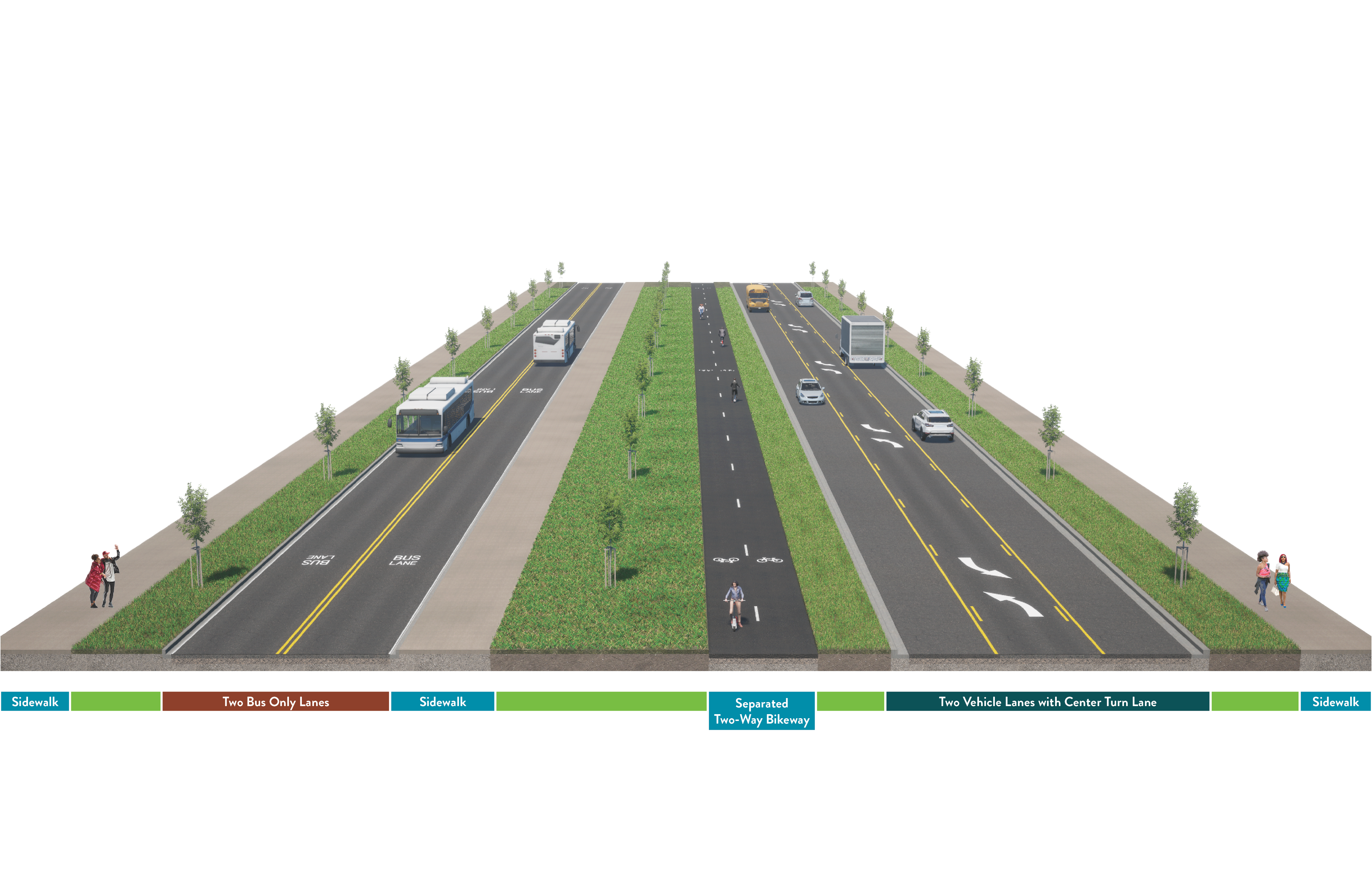
This alternative has two bus only lanes on one side of the road that are separated from the vehicle lanes. The other side of the road has a single vehicle lane in each direction, with a center turn lane. Like the other alternatives, there are sidewalks on each side. However, there is a two-way bikeway within the median.

Please note that some intersections may have additional turn lanes for vehicles, which would increase the number of lanes to cross.

A highway showing two bus only lanes with buses and two sidewalks with people walking on them on the left side of the road. There is a separated two-way bikeway in the median with bikes. On the right side of the road, there are two vehicle lanes with cards, and a turn lane in the middle of the road.

View full size image