Road design
We have created a design for University Ave. Northeast, informed by technical analysis and input from thousands of community members (more information on the input shared is available on our community engagement webpage). The design will increase safety and make University Ave. Northeast easier for everyone to travel on.
For a detailed look at the design for University Ave. Northeast from Central Ave. Southeast to 27th Ave. Northeast, watch the design presentation video.
Features:
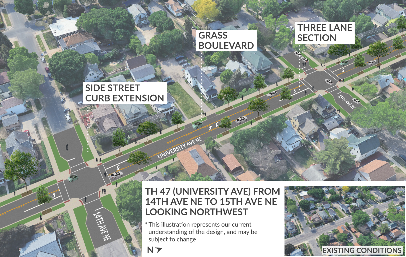
- Narrowing the road to three lanes.
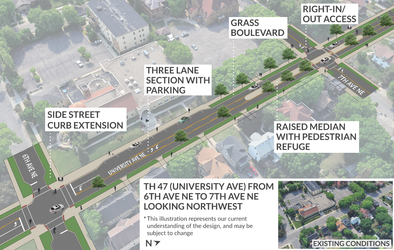
- Creating boulevards to separate sidewalks from the road.
- Widening the sidewalks.
- Adding curb extensions on side streets. These visually and physically narrow the roadway to create shorter crossings for pedestrians and increase visibility.
Benefits:
- Slower vehicle speeds, improved safety for everyone traveling along the road, better accessibility for people walking and rolling on sidewalks, more room for shoveled snow and utilities.
Features:
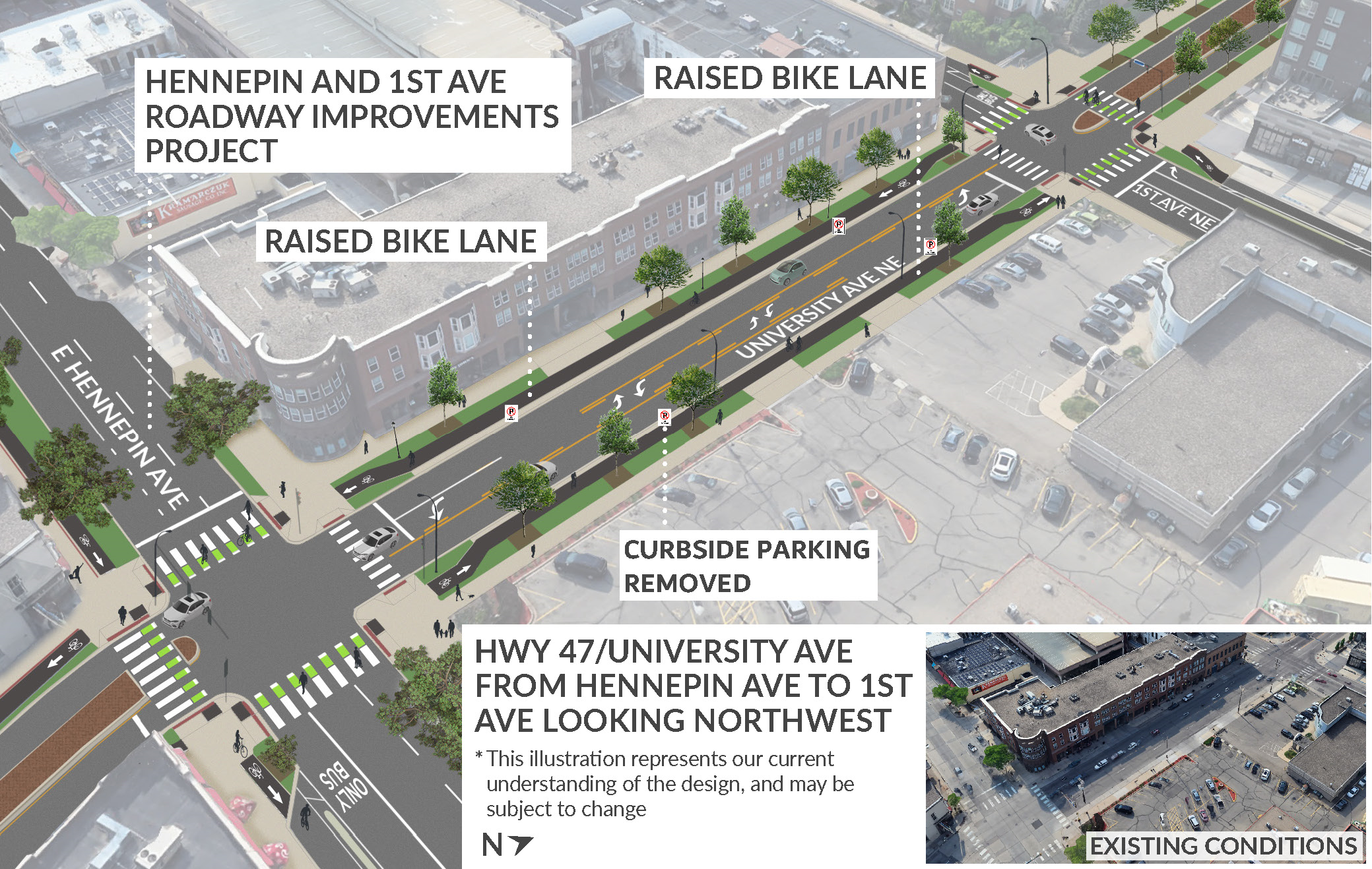
- Adding a bike lane between Central Ave. and 1st Ave. This is identified in the City of Minneapolis’ Transportation Action Plan All Ages and Abilities Bikeway Network.
- Making bike crossing improvements.
Benefits:
- Safer and easier travel experience for people biking.
Medians can help people cross the road because they allow you to cross one direction of traffic at a time. We added medians between travel lanes in the following places on University Ave. Northeast:
- Between 1st Ave. and 3rd Ave.
- 7th Ave. intersection
- 9th Ave. intersection
- 12th Ave. intersection
- Between 16th Ave. and 17th Ave.
- 18th Ave. intersection
- 22nd Ave. intersection
- 26th Ave. intersection
Benefits:
- Improved safety, easier street crossings for pedestrians, slower vehicle speeds.
Features:
- Removing on-street parking along much of the road.
- Keeping key parking spots in the following locations:
- Between Central Ave. and 1st Ave.
- Near 6th Ave. Northeast and University Ave. Northeast
- Near 18th Ave. Northeast and University Ave. Northeast
Benefits:
- Better meets current parking demand and future needs, allow space for widening sidewalks to align with required Americans with Disabilities Act accessibility standards.
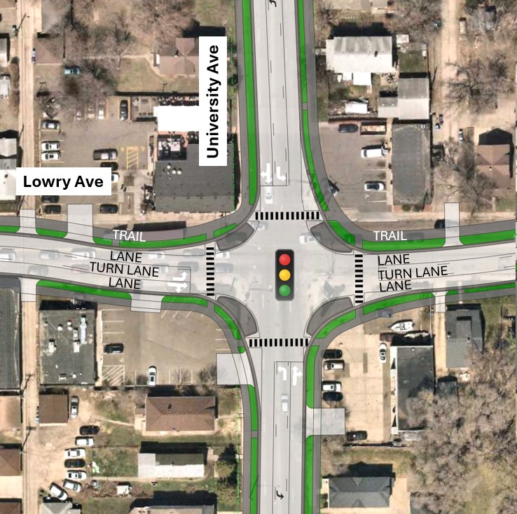
Features:
- Shifting the intersection to the south.
Benefits:
- Lowers the crash rate, including reducing sideswipe crashes.
- Provides the most direct connection across University Ave. for the trail or Shared Use Path on Lowry Ave.
- Offers direct connections for sidewalk and trail crossings, and provides traffic signal audio cues for visually impaired pedestrians.
- Causes fewer traffic delays than adding a roundabout or reducing lanes.
- Provides more space for larger freight vehicles turning.
- Provides more potential for reducing impacts to adjacent properties as the design is refined.
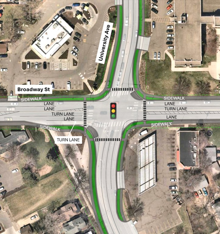
Features:
- Keeping the traffic signal and removing the separate right turn in the southwest corner.
Benefits:
- Eliminates a point of conflict for pedestrians.
- Adds boulevard space between the roadway and the sidewalk.
- Provides more direct connections for pedestrians crossing the road.
- Allows audio cues for visually impaired pedestrians.
- Results in less traffic delays for all users.
- Does not impact any commercial or residential building structures.